Community Archaeology
On 5th & 6th August, the Brecknock Society organised a ‘no dig’ community archaeology project to investigate a site near Penpont, 5 miles west of Brecon, known as ‘Castell Einion Sais’. It’s a bit of a puzzle because there is no trace of a castle, just a nearly flat field. However, the names ‘Cae Castell’ (the Castle Field) and ‘Castell Einion Sais’ (Einion the Englishman’s Castle) have been used here for centuries.
Einion was actually a Welshman who lived in the Lordship of Brecon in the mid to late 1200s. He was descended from Bleddyn ap Maenych, last ruler of the Welsh kingdom of Brycheiniog. Einion’s great-great-grandson was Sir Dafydd ‘Gam’, hero of Agincourt and founder of Breconshire’s powerful Games family.
By about 1780, whatever had stood here was in ruins, which were cleared away when the grounds of neighbouring Penpont were re-landscaped. This was done so thoroughly that ‘not the smallest vestiges of buildings’ remained.
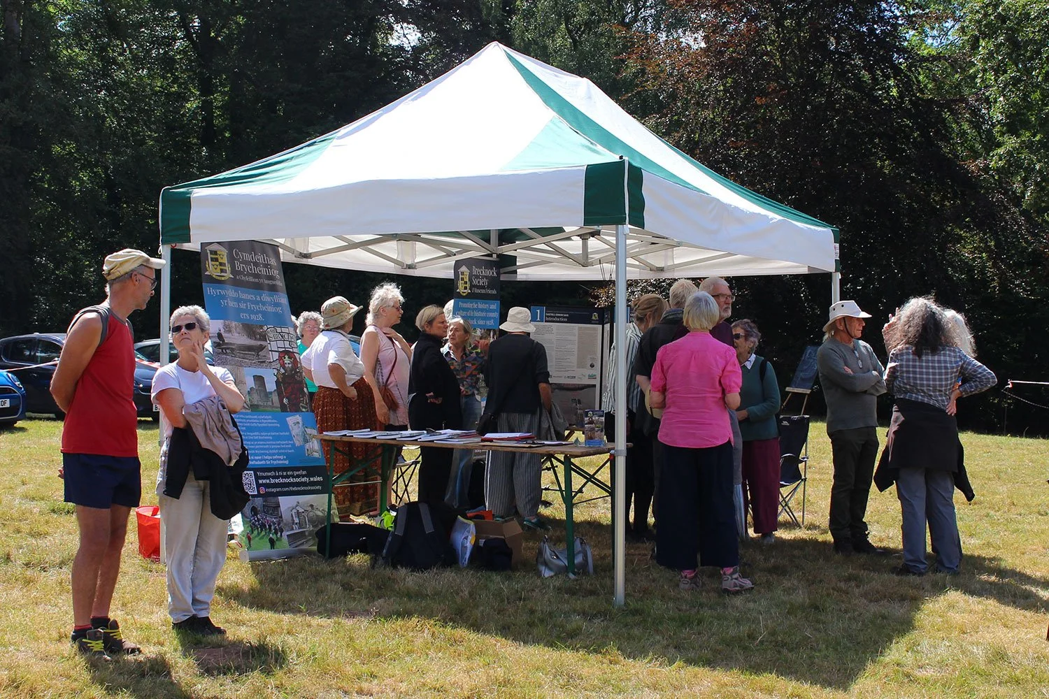
Last year, while working on aerial LiDAR imagery for another project, archaeologist Jennifer Muller noticed a regular square shape around 35 metres across which looked like the remains of a moat. The Brecknock Society organised the present project to investigate this. Volunteers had the chance to do hands-on surveying using modern geophysics techniques, while others ran a drop-in information pavilion open to the public.
Over 30 volunteers and about 120 visitors took part, including 50 who came to a concluding talk. Ages ranged from 10 to 80. Many were local, but one family were on holiday from New Zealand! One keen visitor, who was descended from Einion Sais, had been holidaying nearby at Aberbran when he saw a poster, while others came in search of their Games family ancestors. There were young environmentalists camping at Penpont, people from Brecon Mind, and an archaeology lecturer from London. Particularly wonderful was how everyone mixed, chatted and networked. Get two people with an interest in history or archaeology together and it’s hard to stop them talking!
The Day 1 ‘magnetometry’ survey looked at variations in magnetic field. Volunteers had to dress completely metal-free – a bit of a challenge! We’d hoped this would show the ‘moat’ seen on the LiDAR, but that didn’t show up, although a curious circular feature did stand out. The data is still being analysed and we’ll learn something, but we’re not sure what yet!
On Day 2 the ‘resistivity’ survey measured variations in the conductivity of the soil. But, after the driest July on record, the ground was so parched we got no readings at all!. We did find a damper area where volunteers could practice the technique, but for useful results we’ll have to come back when it’s wetter!
The dry weather wasn’t all bad news. Local drone photographer Richard Parry managed to get a great photo which shows the same ‘moat’ feature as on the LiDAR.
The project was funded by Bannau Brycheiniog’s Sustainable Development Fund. The Penpont Estate and the Action for Conservation charity provided support.
Photo: Drop-in visitors at the information pavilion.